Gold Of Ancient Panama At Gilcrease Museum
PUBLISHED: AUGUST 9, 2011
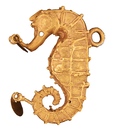
Seahorse effigy pendant, Gran Coclé, 700‱500, gold.
“To Capture the Sun: Gold of Ancient Panama” explores the Gilcrease Museum’s unique holdings of pre-Columbian gold and related ritual ceramics in the largest display of these objects since their acquisition by Thomas Gilcrease in the 1940s.
The exhibition runs through January 15 in the Getty Gallery, and showcases artifacts originally used in the ritual practices of the people of Gran Coclé (the cultural area of ancient Central America that extends geographically from the Bay of Parita to the headwaters of the Rio Grande de Coclé in central Panama). The exhibition includes more than 200 items †gold artifacts used as personal adornments and symbols of authority for social, political and religious elites. A portion of the exhibit examines the rise of metallurgy in the Western Hemisphere and the role that the creation and use of gold ornaments played in the complex cultural networks of early central Panama.
On view are items that demonstrate the complex methods of lost wax casting and the creation of gold-copper tumbaga alloys that became signature processes in the region. It explores the making of gold objects and the role that these processes served in maintaining and enhancing connections with the cosmic forces of ancient belief.
Also revealed is the symbolic and economic significance of gold in the region from pre-Columbian times through the Spanish Conquest, as well as the influence of pre-Columbian gold on the world economies of today.
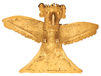
Winged pendant, Gran Coclé, 700‱500, gold.
Over the course of several centuries †from around 700 to 1500 †the people of Gran Coclé practiced elaborate rituals to commemorate the passing of cultural elites. In the sanctity of underground tombs, the remains of important leaders were interred, often along with their retinue. The bodies of these elites were adorned with intricate gold jewelry †incised plaques, finely worked arm bands and bracelets, necklaces †as well as an assortment of human and animal effigy pins and pendants that had previously marked a given leader’s station in life. The burials included the careful placement of ornately decorated ceramic bowls, plates and other containers used in the ongoing veneration of the dead.
“To Capture the Sun: Gold of Ancient Panama” revisits the famed early scientific excavations at Sitio Conte, where archaeologists unearthed a treasure trove of gold artifacts and polychrome ceramics in the 1930s. The exhibition presents the ongoing archaeological research in the region that continues to reveal new information on a still mysterious past, exploring these ancient societies and their use of gold not only in complex burial rites, but also as symbols of power, wealth and privilege.
A companion book,To Capture the Sun: Gold of Ancient Panama, will be published in October and will be available at the museum.
The museum is at 1400 North Gilcrease Museum Road. More information is at http://gilcrease.utulsa.edu or 918-596-2700.
Article
Panama's pre-Hispanic golden artifacts stored out of sight

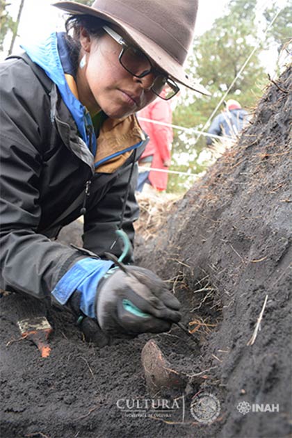
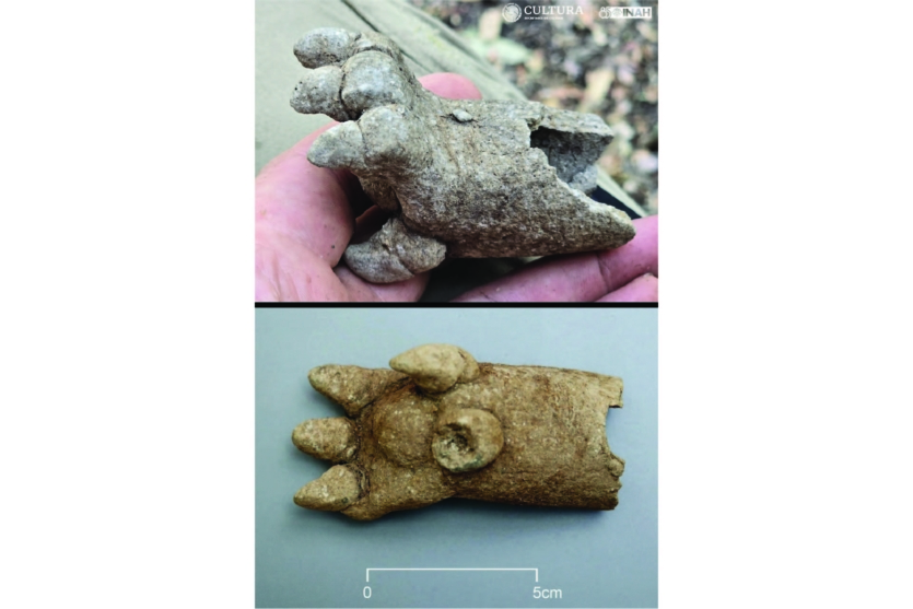
Nine years ago, a trove of intricate gold artifacts were uncovered at a little-known archaeological site in Panama. The treasures dating from over 1,000 years ago included gold beads, strange ceramic pots, and chest plates engraved with delicate designs in forms such as a squid and human face.
But since their discovery by archaeologist Julia Mayo in 2008, those artifacts have also sat in bank vaults and preservation offices in Panama City, leaving the country's little-known archaeological heritage an unintentionally well-guarded secret because the country has no archaeological museum.
Despite Panama's growing commerce and tourism industry, visitors have little opportunity to find out about the country's rich past.
That has left dozens of the startlingly beautiful pieces largely hidden from public view, even as the number of visitors flocking to see the country's skyscraper-studded capital and massive interoceanic canal has more than doubled from 1.1 million in 2011 to 2.6 million in 2016.
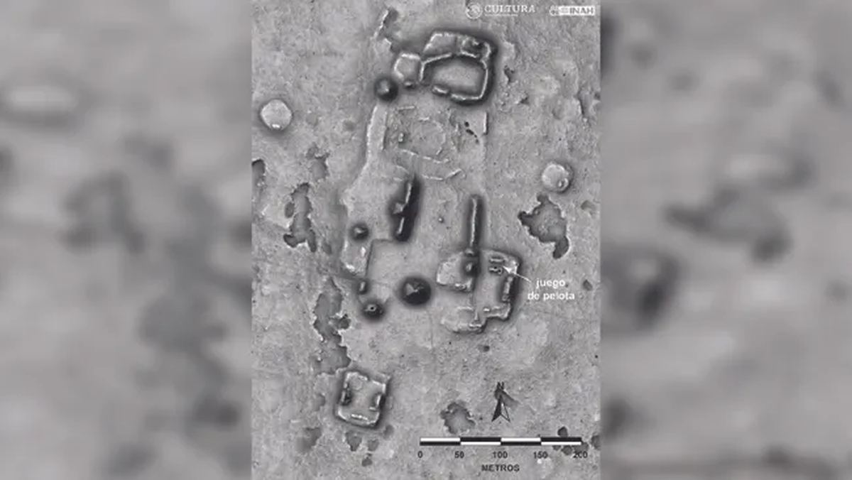
The artifacts, which were found in extensive graves at the Necropolis of El Cano, a site 115 miles (185 kilometers) west of Panama City, include jewelry and decorative objects interred in rich burial offerings.
The tombs, some containing remains of as many as 42 people, were constructed between 700 and 1020 AD by a largely unknown people in an archaeological region known as Gran Cocle.
As experts have worked to understand their cultural significance, however, they have also begun to turn their attention to establishing a permanent home for them.
Officials are working to remodel a now-closed archaeological museum in downtown Panama City and to open a site at the ruins to put the artifacts on display.
Panama City's Reina Torres de Arauz Museum was closed five years ago and is awaiting repairs, but is expected to be reopened in 2019.
Orlando Hernandez, museum coordinator for the National Culture Institute, said the country's museums have long been in decline.
"The public is seeing the imperative necessity for Panama to have some museums that reflect the economic development that we have, but it is an old problem for almost 40 years and we can't fix it one day to the next," he said.
Panama is currently the only Central American country without such a museum.
As a temporary fix in the meantime, officials hope to spruce up a small museum at the excavation site that could be used to display some of the discoveries.
Article
Panama's pre-Hispanic golden artifacts stored out of sight (phys.org)