Tags
Tab Item Content
Join Us!
Archives Meta
Archaeology by Prau...
 
Notifications
Clear all

Archaeology [Sticky] Archaeology by Prau123

1,033 Posts
12 Users
27 Likes
1.8 M Views
Prau123 avatar
Posts: 2529
Topic starter
(@prau123)
Famed Member
Joined: 5 years ago


Where (& How) To See Ancient Petroglyphs In Phoenix


PUBLISHED 14 HOURS AGO


Desert preserves and conservation areas feature an abundance of historic rock carvings.

image
Petroglyphs in Superstition Mountains, East of Phoenix, Arizona, US


Travelers to the Phoenix area enjoy exploring its surrounding desert for all kinds of reasons. They want to see cacti up close, look for wildlife, find unique desert flowers, and embrace the solitude of uncrowded, wide-open spaces. They also can step back in time, by thousands of years, by viewing the wealth of ancient petroglyphs found on rocks and pondering their mysterious origins.


Petroglyphs are rock carvings, versus pictographs, which are rock paintings, and there are said to be millions of them in the Arizona desert. Ancient people made the carvings as far back as 5000 BC, although the Hohokam petroglyphs, which are abundant in the South Mountain Park and Preserve, just outside the city, came later, between 300 AD and 1300 AD, local experts say.


There are more than 7,000 petroglyphs in the South Mountains, where the Salt and Gila rivers meet, and represent the largest concentration of rock art in the area where the Native American Hohokam culture thrived. Given its historical significance, the area is one of the most incredible places to visit in Arizona.


Desert Landscape Offers Glimpse Into Ancient Culture

Hohokam people inhabited central and southern Arizona from about 450 AD to 1450 AD, and the rock patterns they left behind likely mark the places that were important to them, as well as record activities, such as hunting. In the South Mountain Park and Preserve, fascinating rock art is found on many trails, including Desert Classic, Hidden Valley, Holbert Trail, Telegraph Pass Trail, and Pyramid Trail.


Article


Where (& How) To See Ancient Petroglyphs In Phoenix (thetravel.com)


Reply
Prau123 avatar
Posts: 2529
Topic starter
(@prau123)
Famed Member
Joined: 5 years ago


Aztec Vs. Mayans: Basic Differences To Know Before Visiting Ruins

PUBLISHED MAY 17, 2022


Both the Mayans and the Aztecs dwelled in Mexico, but differences between the two civilizations can be seen in their architecture.


mayan tikal temple I in guatemala, Teotihuacán aztec temple in mexico city

Quick Links

The Aztecs and the Mayans are both attributed to being some of the oldest civilizations in North and Central America. While the Mayan timeline goes back further than that of the Aztecs, both were renowned for their architecture and modern contributions to their societies.

Today, ruins from both the Aztecs and the Mayans can be found throughout places such as Mexico. This is also where one will find the most visited of all their pyramids and ancient cities, which can be confusing when it comes to knowing the significant differences between each civilization. Before visiting the ruins of either one, here are some key differences to note in both their architecture and their cultures.


The Mayans: Known For Their Incredible Pyramid Architecture

When one thinks of Mayan ruins, it's common to picture pyramids. The Mayans were known for building incredible structures like these in many of their city-states, many of which are still standing to this day. The most notable difference in architecture throughout the Mayan pyramids can be seen in the stories that they tell, which have been done through a myriad of pictographs and statues, all telling of their gods and beliefs.

Those visiting Mayan pyramids will notice two distinct styles: those which were built for religious worship, and those which were built for gods. The former would usually include a temple at the top which would be used by Mayan priests during ritualistic practices, while the latter would be used for the strict purpose of honoring the god for which it was built. These would also have stairs that were far steeper than that of the religious pyramids, with the likely intention of keeping most people out. Additionally, these are also the pyramids that featured tunnels, trapdoors, and secret doors within.

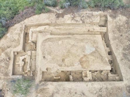
The Most Famous Mayan Pyramids

  • Pyramid of Kukulkan (El Castillo), Yucatán, Mexico
  • Tikal Temple I, Guatemala
  • Temple of the Inscriptions (Palenque), Palenque, Mexico
  • Pyramid of the Magician, Uxmal, Mexico
  • Caana Pyramid, Belize

Additional Features In Mayan City-State Architecture

While the pyramids that the Mayans built had very serious connotations, not everything discovered in their city-states did. Some even had ball courts, which were recognizable due to their smooth floors and rock walls, mimicking that of today's stadiums. These could be attached to temples or located within the city and were used for sporting events.

Additionally, the Mayans also built grand palaces for the king and his royal family. The best example of this, according to Ducksters, is the palace at Palenque, which was built by King Pakal. This palace, alone, was built with several buildings within its complex, as well as a courtyard and an overlook tower.

RELATED:Long Before The Aztecs, This Ancient City Was One Of Largest In The World (And It's A Day Trip From Mexico City)


The Aztecs: Known For The Empire They Built Within Mexico

It is easy to confuse the two civilizations, especially since many Mayan civilizations did live in Mexico and overlapped with the Aztecs. However, the Aztecs lived almost exclusively in Mexico, which is how they were easily differentiated. Later evidence suggests that they lived in Belize, as well, according to Diffen.

  • Fact: Legend has it that the Aztecs settled in Mexico, specifically Lake Texcoco, after seeing a vision that instructed them to do so.

Similar to the Mayans, the Aztecs were known for their pyramids. However, there are far more Mayan ruins still in existence to this day than there are Aztec ruins. Since the Aztecs ruled a trio of cities - Tenochtitlan (modern-day Mexico City), Texcoco, and Tlacopan - this is also where the best-known remaining site of their ruins stands. Templo Mayor can be found in Mexico City, and it was once the location of one of the main temples in Tenochtitlán. Visitors to Mexico City can also find two of the most iconic Aztec pyramids - the Temple of the Moon and the Temple of the Sun - just outside the central region of the city; this is also known as the Teotihuacán (a Mesoamerican center not built by the Aztecs).

The Aztec pyramids are considered to be a classic example of early Mesoamerican architecture. These were structured in a fairly simple manner, with one main core of rubble that was held in place by what is known today as retaining walls. After this foundation was created, the pyramids were then laid with adobe bricks, and covered with limestone. As a result, the Aztec pyramids were flat on the top, featured large, wide steps, and were notably short compared to other pyramids around the world. Similar to the Mayans, the Aztecs often built temples on the flat tops of their pyramids.

Those visiting both Mayan and Aztec ruins in Mexico are in for an incredibly historic experience. While much can be learned prior to visiting, sometimes, knowing the basics of ancient architecture can give one a full appreciation for the civilizations that built the land on which travelers stand.


Article


Aztec Vs. Mayans: Basic Differences To Know Before Visiting Ruins (thetravel.com)


Reply
Prau123 avatar
Posts: 2529
Topic starter
(@prau123)
Famed Member
Joined: 5 years ago


AERIAL SURVEY REVEALS DENSE WEALTH OF PRE-CLASSIC MAYA SITES


AN AERIAL SURVEY WITHIN THE MIRADOR-CALAKMUL KARST BASIN (MCKB) OF NORTHERN GUATEMALA HAS REVEALED A PREVIOUSLY UNKNOWN WEALTH OF PRE-CLASSIC MAYA SITES.

The survey was conducted by researchers from Idaho State University in Pocatello using Light Detection and Ranging (LiDAR), a method of remote sensing using light in the form of a pulsed laser to measure ranges (variable distances) to the Earth.

The differences in the laser return times and measuring the wavelengths can be used to compile a 3-D digital map of the landscape, removing obscuring features which could hide underlying archaeological features.


The survey revealed a dense web of more than 700 archaeological sites, including cities, small settlements, pyramids, reservoirs, ball courts, and 177 km’s of elevated causeways.


A majority of the sites date from around 1000 BC to AD 150 during the Middle and Late Pre-Classic periods, overturning previously held believes that the region was sparsely populated during this time in antiquity.

The interconnections between the sites, along with the labour force needed to build such an undertaking of monumental construction so early in the Maya timeline, indicates that the lowlands were home to a wealthy, unified Maya political system and early centralised administrative structure or kingdom.

The study, Published in the Journal Cambridge Core, Concluded: “LiDAR analyses have demonstrated the presence of dense concentrations of new and previously unknown contemporaneous sites, massive platform and pyramid constructions, including triadic groups, numerous E-Group complexes, causeway networks, ballcourts, and reservoirs that required vast amounts of labour and resources, amassed by a presumably centralised organisation and administration. The skeleton of the ancient political and economic structure as a kingdom-state in the Middle and Late Pre-Classic periods has a tantalising presence in the Mirador-Calakmul Karst Basin.”


Article


Aerial survey reveals dense wealth of Pre-Classic Maya sites - HeritageDaily - Archaeology News


Reply
Prau123 avatar
Posts: 2529
Topic starter
(@prau123)
Famed Member
Joined: 5 years ago


The US' 2,000-year-old mystery mounds
 
The US' 2,000-year-old mystery mounds (Credit: Ohio History Connection)
Constructed by a mysterious civilisation that left no written records, the Hopewell Ceremonial Earthworks are a testament to indigenous sophistication.
A

Autumn leaves crackled under our shoes as dozens of eager tourists and I followed a guide along a grassy mound. We stopped when we reached the opening of a turf-topped circle, which was formed by another wall of mounded earth. We were at The Octagon, part of the Hopewell Ceremonial Earthworks, a large network of hand-constructed hills spread throughout central and southern Ohio that were built as many as 2,000 years ago. Indigenous people would come to The Octagon from hundreds of miles away, gathering regularly for shared rituals and worship. 

"There was a sweat lodge or some kind of purification place there," said our guide Brad Lepper, the senior archaeologist for the Ohio History Connection's World Heritage Program (OHC), as he pointed to the circle. I looked inside to see a perfectly manicured lawn – a putting green. A tall flag marked a hole at its centre.  

The Octagon is currently being used as a golf course.

 
The Hopewell Culture created massive, mysterious earthworks across Ohio (Credit: Mary Salen/Getty Images)

The Hopewell Culture created massive, mysterious earthworks across Ohio (Credit: Mary Salen/Getty Images)

All of these all these prehistoric ceremonial earthworks in Ohio were created by what is now called the Hopewell Culture, a network of Native American societies that gathered from as far away as Montana and the Gulf of Mexico between roughly 100 BCE and 500 CE and were connected by a series of trade routes. Their earthworks in Ohio consist of shapes – like circles, squares and octagons – that were often connected to each other. Archaeologists are only now beginning to understand the sophistication of these engineering marvels. Built with astonishing mathematical precision, as well as a complex astronomical alignment, these are the largest geometrical earthworks in the world that were not built as fortifications or defensive structures. And while most people have never heard about the sites or its builders, that may be about to change.

You could put four Roman Colosseums inside just The Octagon

The US Department of the Interior has nominated eight of Hopewell's earthworks for consideration in 2023 as a Unesco World Heritage site. These include The Great Circle and The Octagon in Newark, Ohio, as well Ohio's first state park, Fort Ancient (not an actual fort). The other five are part of the Hopewell Culture National Historical Park: Mound City, Hopeton Earthworks, High Bank Works, Hopewell Mound Group and Seip Earthworks. 

Lepper told me The Octagon and The Great Circle were once a larger, single Hopewell complex spanning 4.5 sq miles and connected by a series of roads lined by earthwork walls. Walking through both sites today, there is an immediate shock of scale. The Great Circle, where the museum for Hopewell Ceremonial Earthworks is found, is 1,200ft in diameter. Its walls rise up to 14ft high and are outlined on the inside by a deep ditch. The Great Circle was once connected to a square and a burial ellipse, with only part of the square still visible today. The Octagon sprawls a massive 50 acres and is attached to the 20-acre Observatory Circle, a large earthwork circle for gathering and rituals connected to the observation of the night sky.


The earthworks' sophistication has astonished historians (Credit: Ohio History Connection)


The earthworks' sophistication has astonished historians (Credit: Ohio History Connection)

"You could put four Roman Colosseums inside just The Octagon," Lepper told me. Stonehenge would fit within just that small circle now serving as a putting green. He added that 2,000 years ago, indigenous workers built these earthworks without modern tools, digging up soil with pointed sticks and hauling it in wicker baskets on their backs. One estimate, he noted, is that they moved seven million cubic feet of dirt. 

The achievement of the Hopewell Culture, however, is not simply in creating large, precise shapes, which they did without the vantage point of hills for an aerial view. They also embedded a sort of hidden geometry within these structures. Until the mounds were measured and compared, it was thought that the builders didn't have any mathematical and geometrical sophistication, as there are no written records to testify to their level of knowledge. It was eventually discovered, however, that they made precise measurements across their earthworks and connected them in unsuspecting ways. 

Lepper explained that the circumference of The Great Circle "is equal to the perimeter of the perfect square that it was connected to", and that "the area of that perfect square is equal to the area of the [Observatory Circle] that's connected to The Octagon". 

He added: "If you draw a square inside The Octagon by drawing a line from alternate corners of The Octagon, the sides of that square [1,054ft] are equal to the diameter of the circle that it's attached to [1,054ft]."


Examples of the Hopewell Culture's monumental earthworks have been found all over Ohio, including at the Miamisburg Mound (Credit: Gary Whitton/Alamy)


Examples of the Hopewell Culture's monumental earthworks have been found all over Ohio, including at the Miamisburg Mound (Credit: Gary Whitton/Alamy)

Examples of this interplay between earthworks have been found repeatedly by archaeologists. According to Lepper, that measure of 1054ft, whether halved or doubled, is found in other indigenous earthworks across the country, and served as a common unit of measure. 

While the Hopewell Culture's geometrical and mathematical knowledge astonished scholars, another level of sophistication appears when the layers are peeled back further: astronomical alignment.  

In the 1980s, two professors at Earlham College in Indiana, Ray Hively (a physicist and astronomer) and Robert Horn (a philosopher), decided to pay a visit to The Octagon and its attached Observatory Circle. As astronomical monuments like Stonehenge had received great attention, they wondered if these earthworks were also aligned to a solar calendar.  

Hively and Horn found no solar connections, but they then considered an alternative purpose: the lunar cycle.


In the 1800s, white settlers began building their homes around the areas where the earthworks were built (Credit: Quagga Media/Alamy)


In the 1800s, white settlers began building their homes around the areas where the earthworks were built (Credit: Quagga Media/Alamy)

"We thought deliberate lunar alignments unlikely at Newark," they wrote, because while the Sun can be tracked over a year, a complete lunar cycle takes 18.6 years. Even so, the lunar cycle proved to correspond to the position of the Observatory Mound at The Observatory Circle. There, one can watch the Moon rise over the exact centre of The Octagon in the distance every 18.6 years. 

"Astronomical alignments are only relevant and useful if they somehow tie the celestial orbs to belief systems and understandings of life," said Timothy Darvill, professor of archaeology at Bournemouth University who has researched both Stonehenge and the Hopewell Ceremonial Earthworks. "The ceremonies around the observation of the skyscape could well have a secondary function in terms of fostering community."  

That ancient community and culture is part of the case being made to Unesco. 

A Unesco site needs to show that it has "outstanding universal value", said Jennifer Aultman, director of historic sites and museums at Ohio History Connection and the Ohio lead for Unesco consideration. One criterion for this, she said, "is that these are masterpieces of human creative genius", which is where these mathematical, geometrical and astronomical features are important. The other, "is that they bear really exceptional testimony to the cultural tradition that produced them".


In recent years, the area near the Octagon has been used as a golf course (Credit: Brandon Withrow)


In recent years, the area near the Octagon has been used as a golf course (Credit: Brandon Withrow)

Aultman explained: "You really can understand something about the lives of the people and what mattered to them by looking at, and learning about, the earthworks." 

Consider the Moon, for example, which was clearly important for the Hopewell Culture. Darvill told me that, for some cultures, the "Sun, Moon... are considered to have power over what happens on a day-to-day basis. As such, the heavenly bodies are often deified, which is how their power is justified and rationalised." It is therefore likely that the Moon was a deity shared by those who gathered at the mounds. 

"The land we know as Ohio is home to a number of extraordinary earthworks built by indigenous residents of this region thousands of years ago," said Megan Wood, executive director and CEO of the Ohio History Connection. While not all earthworks in Ohio are specifically Hopewell Mounds – such as the solar-aligned Serpent Mound Historical Site in Peebles, Ohio, for example – Wood sees them all as "icons" of indigenous "cultural achievements". 

Since the Hopewell Culture left no written records, only the earthworks and the few objects retrieved from them serve as their last cultural testimony. While archaeological excavations continue on some sites, objects like ritual smoking pipes and a small stone statue of a shaman wearing a bear skin and holding a human skull called "the Shaman of Newark" have been found. As these earthworks were gathering places and not villages, artefacts representing the locations from where these indigenous peoples travelled have also been discovered, like effigy pipes, a copper head plate and an obsidian knife.


Because they left no written records, the Hopewell remain something of a mystery to anthropologists (Credit: Caleb Hughes/Alamy)


Because they left no written records, the Hopewell remain something of a mystery to anthropologists (Credit: Caleb Hughes/Alamy)

However, after the Hopewell Culture gradually began to disappear starting around 500 CE, other indigenous peoples stepped in to become caretakers of the land. One of those groups was the Shawnee Tribe, which called Ohio home before they were forcibly removed west of the Mississippi River in the 1830s. 

"We may not have been responsible for building or creating them, but I know that my ancestors lived there, and that my ancestors protected them and respected them," said Chief Glenna Wallace of the Eastern Shawnee Tribe of Oklahoma, who believes that other tribes should have a role in the future of protecting the Hopewell Earthworks and communicating their cultural importance. 

However, receiving Unesco status is a difficult, bureaucratic process. While sitting on land owned by the OHC, The Octagon is under the control of the Moundbuilders Country Club. The club negotiated an unprecedented lease that extends until 2078 and only allows visitors to walk the mounds four times a year. The rest of the time, visitors can access a platform in the car park to view a very small section of the property. OHC is currently suing to evict the country club (with compensation) through eminent domain. The lower courts ruled in favour of the historical society, but the Ohio Supreme Court is hearing an appeal. If OHC can't guarantee public access, this may impact Unesco's decision.

A small public viewing platform allows visitors to see the mounds across the golf course (Credit: Brandon Withrow)

A small public viewing platform allows visitors to see the mounds across the golf course (Credit: Brandon Withrow)

While a Unesco designation wouldn't entail the return of land or reparations, it does mean greater local representation and education about Ohio's Native American history. It also means more indigenous stakeholders, like the Shawnee, telling that story from an indigenous perspective for future generations.

"I just want people to know about it," said Chief Wallace, "I want people to be able to see it. I want people to be able to visit it and want people to realise that it is a cultural phenomenon. That it's priceless."


The US' 2,000-year-old mystery mounds - BBC Travel


Reply
Prau123 avatar
Posts: 2529
Topic starter
(@prau123)
Famed Member
Joined: 5 years ago


Long-lost ancient mural rediscovered in northern Peru after more than a century

Swiss archaeologist Sâm Ghavami with his team of Peruvian students at the Huaca Pintada in northern Peru.
Swiss archaeologist Sâm Ghavami with his team of Peruvian students at the Huaca Pintada in northern Peru. Photograph: Sâm Ghavami


Student archaeologists unearth Huaca Pintada, described as ‘the most exciting and important find of recent years’


A team of student archaeologists has rediscovered a 1,000-year-old multicoloured mural depicting a deity surrounded by warriors which was last seen a century ago in northern Peru.


Macchu Picchu – or as it should be called – Huayna Picchu.
Machu Picchu: Inca site ‘has gone by wrong name for over 100 years’
Read more
 

Known as the Huaca Pintada, the 30-metre-long wall painted with fantastical images depicting mythical scenes was first found in 1916 by a band of treasure-hunting tomb raiders in Illimo near the city of Chiclayo.

The full splendour of the mural was captured in photographs taken at the time by Hans Heinrich Brüning, a German ethnographer whose work galvanised the archaeological study of the pre-Columbian ruins and relics in the region.

But then the grave robbers destroyed part of the wall after being forbidden from looting their find, and the site fell back into obscurity.


More than a century went by until a Swiss-Peruvian team led by Sâm Ghavami from the University of Fribourg decided to take on the mystery and rediscover the lost mural which had disappeared from view under carob trees and undergrowth.


Sâm Ghavami uses a brush to reveal the mural.
Sâm Ghavami uses a brush to reveal the mural. Photograph: Sâm Ghavami


“When we got access to the site, it was a huge relief,” Ghavami, 33, told the Guardian by phone from northern Peru. One of the main challenges was accessing the site which is located on private land, he explained. It took two years to persuade the fiercely protective landowning family to allow them to excavate.

The Swiss archaeologist and some 18 Peruvian students began excavations in 2019, thanks to a grant from the Swiss National Science Foundation. After a pause in 2020 due to the Covid-19 pandemic, they were able to continue in 2021 completing the dig in November this year.


A detail from the mural.
A detail from the mural. Photograph: Sâm Ghavami
 
Experts believe the shrine was built by the pre-Columbian Cupisnique culture, which developed along Peru’s northern coast more than 3,000 years ago.
Archaeologists identify 3,200-year-old temple mural of spider god in Peru
Read more


“It was a lot of work,” said Ghavami. “No one could see its monumentality when it was covered by trees.

“When that was cleared away, people start to see it in a new way,” he added.

Archaeologists believe the mural dates back to the Lambayeque culture of the 9th century AD. It was buried in a pyramidal mound in La Leche valley near another site called Túcume, in the Lambayeque region.

“It’s the most exciting and important find of recent years,” said Luis Jaime Castillo, an archaeology professor at the Pontifical Catholic University of Peru. “The long-lost murals of Huaca Pintada have been recuperated after more than 100 years.”

The excavation site on private land near the city of Chiclayo.
The excavation site on private land near the city of Chiclayo. Photograph: Sâm Ghavami


“The depictions have a mixture of Mochica and Lambayeque iconography,” said Castillo. The Mochica civilization flourished in the region between AD100 and 700. “They show a transition, and maybe changes in the cosmologies.

“They give us a unique opportunity to contemplate the ancient societies of northern Peru, their deities and myths,” he added.

For now, the site has been covered up to preserve it but Ghavami – who is writing his doctoral thesis about the sociocultural changes that occurred in Lambayeque at the time when the mural was made – would like it to be restored to its former glory and, eventually, opened to the public.


Article


Long-lost ancient mural rediscovered in northern Peru after more than a century | Peru | The Guardian


Reply
Page 88 / 195