Tags
Tab Item Content
Join Us!
Archives Meta
Archaeology by Prau...
 
Notifications
Clear all

Archaeology [Sticky] Archaeology by Prau123

1,649 Posts
12 Users
27 Reactions
4.3 M Views
Prau123 avatar
Posts: 3145
Topic starter
(@prau123)
Famed Member
Joined: 6 years ago


Gold Glitters In The Forest Of Peru In A Photo Taken By An Astronaut

Gold mining is so prolific in this part of Peru it can be seen from low-Earth orbit.


author

TOM HALE


Senior Journalist

clockPublished April 7, 2023
share1.8kShares
 
The gold-laden forests of eastern Peru as seen from the ISS on December 24, 2020.
 

The gold-laden forests of eastern Peru as seen from the ISS on December 24, 2020. Image credit: Earth Science and Remote Sensing Unit/NASA Johnson Space Center


High above the Peruvian Amazon, the forests beam with gold. While the glittering pits might look pretty from low-Earth orbit, the image actually highlights a worrying problem back home on planet Earth.

An astronaut on board the International Space Station (ISS) took this photograph of gold prospecting pits while drifting above eastern Peru on Christmas Eve 2020. Perfectly hit by the Sun’s beams, the gold-rich pits beam back with a radiant reflection. 

As explained by NASA Earth Observatory, the prospecting pits consist of hundreds of tightly packed water-filled basins surrounded by de-vegetated areas of mud. 

The worm-like interwoven channels on the left side of the image are the Inambari River and the Tambopata National Reserve, which is legally protected from mining, is also visible just below the clouds in the top right of the photo. Although the photograph has been lightly edited to improve contrast, it was simply taken with a commercially available Nikon D5 digital camera. 


A zoomed-in version of the image above with labeled locations.
 
A zoomed-in version of the image above with labeled locations. Image credit: Earth Science and Remote Sensing Unit/NASA Johnson Space Center

Gold mining is big business in Peru, the sixth-largest producer of the precious metal in the world. Unfortunately, some of this extraction is fueled by illegal mining, involving destructive processes that devastate the local environment and Amazonian communities. 

In recent years, there have been ongoing troubles in Peru’s Madre de Dios where a modern-day gold rush has seen makeshift cities pop up and recklessly exploit the environment for metals. Along with extensive deforestation – an area roughly the size of New York City, by some counts – it’s also introduced floods of polluted water in the surrounding ecosystem. 

One of the main concerns is mercury and its highly toxic cousin methylmercury. Gold miners sometimes use mercury to separate their gold ore from soil and sediments, often without adequate safety precautions. The mercury, itself a potent neurotoxin, seeps into ponds and can then be converted into the super-toxic chemical methylmercury through microbial processes.

This has become a growing problem in Peru and other parts of South America. On top of dealing with mercury poisoning and the environmental impact of illegal gold mining, Amazonian communities have also been subject to violence from gold mining encroaching on their land. 

In the early 1990s, for example, a group of miners entered the village of Haximú in Brazil and massacred 16 Yanomami people, including a baby, eventually resulting in five miners being found guilty of genocide. More recently in 2020, two Yanomami people were reportedly killed after a confrontation with gold miners in northern Brazil.

As of 2023, Brazil’s new government has taken steps to crack down on illegal gold mining in the Amazon rainforest, but the problem continues to linger across South America.

An earlier version of this article was published in February 2021.


Article


Gold Glitters In The Forest Of Peru In A Photo Taken By An Astronaut | IFLScience


Reply
Prau123 avatar
Posts: 3145
Topic starter
(@prau123)
Famed Member
Joined: 6 years ago


Let’s talk about that ‘Mayan scoreboard’ found at Chichén Itzá

 
Carlos Rosado van der Gracht

Carlos Rosado van der Gracht

Born in Mérida, Carlos Rosado van der Gracht is a Mexican/Canadian blogger, photographer and adventure expedition leader. He holds degrees in multimedia, philosophy and translation from universities in Mexico, Canada and Norway. Sign up for the Yucatán Roundup, a free newsletter, which delivers the week's top headlines every Monday.


The stone disk found at Chichén Itzá’s Casa Colorada is being photographed extensively for preservation purposes. Photo: INAH

The recent discovery of a stone disk referred to as a “Mayan scoreboard” at Chichén Itzá made waves across the world last week. The discovery is important, but much of the coverage is incorrect or, at the very least, incomplete.

A section of the Casa Colarada complex is undergoing extensive reconstruction. Photo: Carlos Rosado van der Gracht / Yucatán Magazine

One of the claims circulating is that this object, now nicknamed by experts as the “ball players disc,” was used to keep score during the ”match.”  Though it’s impossible to say with absolute certainty what purpose the disc had, there is no evidence to suggest that it was actually used for scorekeeping. 

 
Though researchers have a general idea of how the Mesoamerican ballgame/ceremony was performed, there are still many questions to be answered. Photo: Carlos Rosado van der Gracht / Yucatán Magazine

The object is 9.5 centimeters thick, with a diameter of 32.5 centimeters, and weighs roughly 40 kilograms. Sculpted into circular stone is a scene depicting two players wearing ceremonial regalia. 

The player on the left appears to be wearing a feathered crest, while the player on the right is adorned with what is described as a serpent turban — a fairly common motif in Chichén Itzá. Surrounding the scene are several glyphs, including the date 12 Eb 10 Cumku on the short count calendar, which corresponds to the year 894 CE. 

A stone relief of a Mesoamerican ballgame found in Yaxchilán, Chiapas. Photo: Carlos Rosado van der Gracht / Yucatán Magazine

It is notable that both figures represented on the object are of the same size, which suggests that they were of similar status, unlike other scenes often seen in Mesoamerican art which depict victors and/or rulers towering above vanquished foes. 

Lintel 1 of Bonampak over the doorway of Room 1 depicts Lord Chaan Muwakn capturing an enemy. Photo: Carlos Rosado van der Gracht / Yucatán Magazine

This remarkable object was discovered within a collapsed arch in Chichén Itzá’s Casa Colorada complex, not the grand ballcourt as has been reported by several outlets. Experts now believe the disk was embedded within this particular archway found half a meter below the surface, which served as one of the entrances to the Casa Colorada complex. 

The facade of La Casa Colorada in Chichén Itzá, Yucatán. Photo: Carlos Rosado van der Gracht / Yucatán Magazine

Though much smaller than Chichén Itzás grand ballcourt, which is by far the largest in Mesoamerica, it is by no means small; and is, in fact, larger than average.

Archaeologist at work in February 2023 on the eastern end of the Casa Colarada complex in which the stone disk was discovered. Photo: Carlos Rosado van der Gracht / Yucatán Magazine

The stone disk was discovered by INAH archaeologist Lizbeth Beatriz Mendicuti Pérez. The find is significant for several reasons, including that it contains the first legible glyphs found at Chichén Itzá in just over 11 years.

Several media outlets took this to mean that evidence of Mayan glyphs is rare in Chichén Itzá, which is not at all the case. Rather, this is a byproduct of the fact that the site is already one of the most thoroughly excavated and researched in all of Mexico.

The confusion over its utility as some kind of scoreboard likely stemmed from a translation error. The word marcador in INAH’s Spanish-language press release can mean “scorekeeper.” But the word can also be used to make reference to a particular location, as in “X marks the spot.”

The grand ballcourt at Chichén Itzá is one of the 13 structures of its kind at the site, and the largest in Mesoamerica, measuring a stunning 96.5 meters long and 30 meters wide. Photo: Carlos Rosado van der Gracht / Yucatán Magazine

It is relevant to note that several objects associated with Mesoamerican ballcourts have been referred to as markers, including stone discs often found at the center of these ceremonial complexes.

Ballcourt at Xanila Park with a market in the center of the field. Located in the Caucel neighborhood of Mérida, Yucatán. Photo: Carlos Rosado van der Gracht / Yucatán Magazine

The Mesoamerican ballgame known in Yucatán as Pok ta Pok traces its origins back to the second millennium BCE. But in fact, this game is really best described as a ceremony. It is widely believed to be a metaphor for the constant battle between the forces of good and evil — life and death. In some places and times, ritual sacrifice was a component of the ceremony, with war captives being the most common victims.

A carved stone panel from Chichén Itzá’s grand ballcourt depicts a decapitated man on one knee with blood pouring from his neck in the form of serpents. Photo: Carlos Rosado van der Gracht

During the game, players struck the ball with their hips through an elevated stone hoop. Or at least this is believed to be the case most of the time. That being said, some versions of the ceremony allowed the use of forearms, rackets, or bats. The ball was made of solid rubber and weighed as much as 4 kilograms / 9 pounds.

A closeup of the right marker of the “hoop” of the grand ballcourt in Chichén Itzá. Photo: Carlos Rosado van der Gracht / Yucatán Magazine

It is also the case that some ballcourts do not have rings at all but point markers, as is the case with Copán’s famous ballcourt, featuring six stone macaw heads, three on each side. 

Though these days, the ballcourt at Copan is seen as somewhat of an oddball, it is likely this alternative ballcourt design was not unique. Photo: Carlos Rosado van der Gracht / Yucatán Magazine

Similarly, the main ballcourt at Tonina features six serpent heads, again with three on each side. 

The grand Maya city of Tonina sits high in the mountains of Chiapas and is home to one of the largest architectural complexes in all Mesoamerica. Photo: Carlos Rosado van der Gracht / Yucatán Magazine

Mesoamerican ballcourts also show a high amount of regional and cultural variation when it comes to their overall design, with, for example, ballcourts in the mountains of Guatemala and Central Mexico tending to be sunken.

A ballcourt in Mixco Viejo sits in the mountains surrounding Guatemala City. Photo: Carlos Rosado van der Gracht / Yucatán Magazine

Mesoamerican ball courts have been found as far north as Arizona (arguably) and as far south as Nicaragua. Over the past few decades, the Pok ta Pok has become a popular tourist spectacle, but the ceremony is still practiced by a handful of communities in Mexico, including the Ulama of Sinaloa.

A particularly stunning Mesoamerican ballcourt in Yaxha, Guatemala. Photo: Carlos Rosado van der Gracht / Yucatán Magazine

Though the Mesoamerican ballgame clearly was ritualistic, textual evidence from Mixteca codices suggests that it was also played for recreation — without the decapitations, of course.

A highly dramatized reenactment of the Pok ta Pok “game” in Xcaret, Quintana Roo. Photo: Carlos Rosado van der Gracht / Yucatán Magazine

In Yucatán, there have been a handful of attempts to revitalize the ancient ceremony by holding tournaments with teams from multiple communities and even a Pok ta Pok world cup, which was last won by the team representing Belize.


Article


Let's talk about that 'Mayan scoreboard' found at Chichén Itzá (yucatanmagazine.com)


Reply
Prau123 avatar
Posts: 3145
Topic starter
(@prau123)
Famed Member
Joined: 6 years ago


image


The Isle of Pines Mounds: A South Pacific Mystery Solved?


A small, picturesque, island in the French territory of New Caledonia hides a mystery that continues to defy rational explanation. More than 400 grass-covered mounds, averaging two or three meters in height, dot the Isle of Pines. At first glance, these “tumuli,” as they are termed by scholars, look unremarkable. But a handful of excavations in 1959-60 revealed what lies hidden inside them - mysteries that still confound archaeologists and historians, who as recently as 2015 termed them “a kind of archaeological nightmare.”

Nothing resembling these structures has been discovered anywhere else, except a small number on the main island of the country. Every attempt so far by archaeologists and historians to explain why they were built, and by whom, has failed - spectacularly - and the current mainstream theory only works if we ignore what the excavations have uncovered.


View of vegetation-covered tumulus on the Isle of Pines. (Author provided)

View of vegetation-covered tumulus on the Isle of Pines. (Author provided)


The Mysterious Mounds on the Isle of Pines


The first puzzle is that inside each rounded mound of iron gravel and soil sits a large and very heavy cube of solid, high-quality,concrete. These blocks average 2 - 2.5 meters (6-8 feet) high. Carbon dating of snail shells attached to the outside of the concrete suggest it was made as far back as 10,000-12,000 years ago - many millennia before concrete was first manufacturedanywherein the world.

Concrete technologyin the South Pacific was actually unknown until the European arrival just two centuries ago. Not only that, this dating is thousands of years beforeanyhumans arrived in these islands. But there is more.

A smooth, circular, shaft about 30 cm (1 foot) wide runs vertically down the center of each concrete block. Directly below the shaft, below ground, sits a large cone or top-shaped object made of iron, pointing down about 2 meters (6 feet) long. Rings of iron nuggets surround this object and also the core itself. The purpose of this metal object remains an enigma.


Tumulus interior excavation sketch. (Author provided)

Tumulus interior excavation sketch. (Author provided)


Previous Explanations


The first proper excavation took place in 1959, when locals on the Isle of Pines used one of the tumuli as a source of iron gravel for road repairs. This activity stopped, however, when the workers unexpectedly encountered its large concrete core that proved immune even to dynamite.

French archaeologist Luc Chevalier hurried to investigate and then made the first - and most complete to date - excavation of a tumulus. This study was the first time the mysterious artifacts inside these structures were revealed and it provided samples for testing.

However, just as the large cone-shaped metal object was exposed, the sides of the site threatened to collapse and the excavation ended as the team scrambled to safety. Perplexed by what the dig had revealed, Chevalier continued his research back inNoumea. He later investigated several tumuli on the mainland, which had also been destroyed or damaged, but did not resume the excavation on the Isle of Pines. Chevalier published his findings and a long list of unresolved questions in 1963. His original report (in French)can be readily accessed online.

Before this took place, however, researchers and writers had begun speculating that this huge building project on a remote, isolated, island might represent the work of an unknown advanced civilization long ago, perhaps visiting from Japan or Asia, or a mythical kingdom such as Mu, Lemuria, or Atlantis. Even a visiting extraterrestrial civilization was proposed as a possibility.

One of the more insightful conclusions came in a 1949 paper by the French geologist Jacques Avias. Without being more specific, he proposed a series of ancient arrivals in the southern Pacific, predating the Melanesians, concluding “…at least the following hypothesis can be put forward: a civilization …preceded the present Kanak civilization…this civilization had a Neolithic industry more advanced than the indigenous people."

It was not long before conservative thinking replaced such exotic ideas with more acceptable, down-to-earth, possibilities. The most enduring of them was that the mounds were actually made by long extinct giantmegapodebirds, to hatch their eggs in. It was suggested that the birds kicked up the soil until it formed a mound where eggs could be laid, warmed by decaying vegetation placed by the birds in the hole. Initially, the concrete core was explained away as the wholly natural action of microorganisms, tiny globules of calcite in the soil somehow binding rocks and debris together.


Top: Australian brushturkey on its mound. (D. Cowell/CC BY 3.0) Bottom: Cross-section of a typical megapode mound. (Peter Halasz/CC BY SA 2.5)

Top: Australian brushturkey on its mound. (D. Cowell/CC BY 3.0) Bottom: Cross-section of a typical megapode mound. (Peter Halasz/CC BY SA 2.5)


Subsequently, a refinement of the theory proposed that themegapodestidily excreted into the hole in the top of the mound, the feces becoming the heating agent for the eggs. Over time, the bird droppings are presumed to have fossilized and become the “cement” found today. Although chemical analysis established early on that the concrete core had none of the elements found in guano, many scholars and historians uncritically accepted this fiction as it did not challenge the accepted dates for human arrivals in the islands of New Caledonia.

The avian theory was dealt a fatal blow in March 2016 with publication of a paper by a group led by an Australian-based paleozoologist, Trevor H. Worthy. After noting the obvious implications of the complete absence of any shell fragments in or near the tumuli, the paper reported that skeletal remains of the megapodes established rather conclusively that the birds were not, in fact, physically equipped for any type of mound building and particularly not mounds on the scale found in New Caledonia.

Instead, in their paper Worthy and his team made their own proposal to explain the tumuli’s origins, suggesting that some “interplay between vegetation and erosion” somehow combined to erode the soil into the shapes we see today. It was a rather short-lived idea.


Top: The remains of the concrete core excavated by Chevalier in 1959. Bottom: A view looking up its central shaft. (Author provided)

Top: The remains of the concrete core excavated by Chevalier in 1959. Bottom: A view looking up its central shaft. (Author provided)


The Creations of People Not Birds!


The following year, in 2017, leading French archaeologist, Louis Lagarde, based in Noumea, published a landmark paper,“Were those mysterious mounds really for the birds?”that convincingly brought down the final curtain on the megapode theory. This, of course, was a tremendous step forward; by arguing that the tumuli were made bypeople, not by birds or curious weather, Lagarde seemed to open the door to more sensible explanations. Such did not prove to be the case.

Despite this promising development and the admission that no bones, human or otherwise, have ever been found inside these mounds, Lagarde then claimed that the tumuli were, after all, merelyburialmoundsconstructed by the local population over the last 2,000 or so years. He explained the lack of bones by proposing that over the centuries soil acidity and some undefined “exposure to the elements” had corroded them completely away.

Most stunningly, despite his own well documented personal field experience and first-hand knowledge to the contrary, he went on to claim that the tumuli contain no archaeological materials! With that single statement, the concrete cores, the rings of iron nodules carefully placed around them, the perfectly circular shafts in the center of the cores, and the large metal cone-shaped object beneath it were all dismissed.

Questions Going Beyond the Mainstream

By now, the reader has probably noticed that all the mainstream “explanations” have had one thing in common: to make their case they have had to ignore what isactuallyinside the tumuli. This latest theory has had to do the same. Surely it will have future historians and scientists scratching their heads about the state of 21st century archaeology, in theSouth Pacificat least.

And there, so far as consensus thinking is concerned, the matter rests. But the questions raised by French archaeologist Louis Chevalier after making that first excavation still seek answers:

Who were the builders? Where didtheir ability to make high-quality concretecome from at a time when this technology was unknown? Where did they go?

What possiblemotivationor purposecould cause people to invest so much effort to erect more than 400 of these structures [each averaging a volume of 500 cubic meters]?

Why did such a massive effort leave no other traces -no tools, bones, charcoal, pottery, or other cultural artifacts - either within the tumulus or around it?


Young pine trees on Île des Pins (Isle of Pines), New Caledonia. (bennytrapp /Adobe Stock)

Young pine trees on Île des Pins (Isle of Pines), New Caledonia. (bennytrapp/Adobe Stock)


Why did they not use this concrete-making ability to construct other works- their houses and other important buildings, their burials, and their sacred places?

Finally,why was the ability to manufacture such a useful material as concrete not exported to otherislands?Why was it not passed down to later people? Indeed, why did this ability not arise elsewhere in the region?

Revealing the Construction Sequence

Full answers to these questions remain to be found, but the author’s investigations inNew Caledoniasince 2017 have already made some things clear. This has included having new chemical analysis in Australia of the coral-based concrete. The latest technology available has confirmed the results reported in the pioneering studies.

Close examinations of the tumulus excavated by Chevalier revealed features that his team had missed. This allowed a minimal construction sequence to be hypothesized, requiring at least 9 distinct stages to produce a single tumulus and an enormous amount of concrete to form the core. Of course, all this had to be repeated hundreds of times to create the structures we see today.

The nine stages required, at a minimum, to erect each tumulus based on what excavation has already revealed. (Author provided)

The nine stages required, at a minimum, to erect each tumulus based on what excavation has already revealed. (Author provided)

Parts of the Mystery at the Isle of Pines are Solved

Simple engineering logic tells us what the purpose was for all this effort -the tumuli were built to stabilize - to an exceptionally high degree - some type of pylon or pillar in their shafts, but we do not yet know the purpose for thepylonitself. What did it support? Why did it have to be so rigid? And, as none remain today, what happened to the hundreds of pylons?

Other pieces of the puzzle falling into place include the fact that nothing to date suggests that thetumuli constructiontook place over an extended period where we would expect to see improvements, improvisations, or the development of different styles. Everything suggests a one-time concentrated effort.

Only two of the Paita tumuli on the main island preserve any trace - surplus raw material - of the construction process and, just possibly, of a stage of early experimentation with local materials. If so, we can speculate that the silica-based process may have been abandoned in favor of theiron resourcesreadily available on the Isle of Pines.


A tantalizing new question has also risen: the Isle of Pines is dominated by the “Iron Plateau,” so named for the abundance of iron in the form of gravel and nuggets; could this have anything to do with why thetumuli builderschose to build there? Is this a hint that some type of advanced technology was involved?

Determining all this is now the challenge going forward. Ascertaining the function of the cone-shaped metal object beneath the shaft may offer the most promising line of future investigation. More work is obviously needed to resolve the mystery, but it will require people able to accept archaeological realities and who have open minds, not merely gate-keepers for outdated concepts.

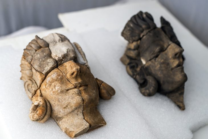
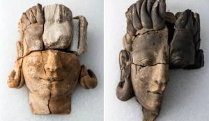
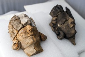
Top Image: The mounds on the Isle of Pines have remained a mystery for years.   Source:


Article


The Isle of Pines Mounds: A South Pacific Mystery Solved? | Ancient Origins (ancient-origins.net)


Reply
Prau123 avatar
Posts: 3145
Topic starter
(@prau123)
Famed Member
Joined: 6 years ago


Exploration Mysteries: Rongorongo, the Hieroglyphics of Easter Island


Because of Easter Island’s remote location at the edge of the Polynesian Triangle, historians have been unable to put together a clear picture of the island’s original inhabitants. This enigmatic culture includes a script called Rongorongo, which linguists have been trying to decipher since the 1800s. 

A culture in crisis

The word Rongorongo means “to recite, to declaim, to chant out” in native Rapa Nui. Discovered on Easter Island in the 19th century, it remains the only ancient writing system found in Polynesia. The script itself consists of around 120 symbols drawn from nature, ranging from fish to plants and vegetables. It has over 450 variants, and these can be further expanded into thousands of compound symbols.

Researchers have managed to make out certain characters like sea turtles, centipedes, trees, men, and possibly deities. Supposedly, Rongorongo’s symbols go from left to right and bottom to top. As to what the writing means on the various tablets on which they are found, we still do not know. 


rongorongo script

Rongorongo symbols. Photo: Sebastian Englert in ‘Island at the Center of the World’ (1970)


These symbols were etched by sharp objects such as shark teeth into wooden tablets. Twenty-five of these tablets remain today. They are not uniform and vary greatly in shape. You can find them in local and international museums such as the Museo Rapa Nui and the Ethnological Museum in Berlin.

Despite the lack of information and mystery surrounding Rongorongo, historians agree that it was probably reserved for the higher, more literate classes in society. The main literate group was the priestly class. The Rapa Nui people mostly relied on oral tradition.

We can also deduce that Rongorongo was reserved for more important purposes like religious ceremonies rather than day-to-day life. Part of the reason for the mystery behind this language is that the inhabitants of Easter Island were wiped out or taken by Peruvian raiders and diseases. Then, as Christianity spread among the small local population, Rongorongo’s relevance diminished. Thus, any knowledge of this language remains severely limited. 

The quest for answers

The mention of a native writing system appears in several Western accounts. French missionary Eugene Eyraud, the first Westerner to settle on the island, described wooden tablets in local houses. However, he noted that they did not know how to read the hieroglyphs inscribed on them.


symbols

Symbols of Rongorongo. Photo: omniglot.com


The first to attempt to crack this code was the Bishop of Tahiti, Florentin-Etienne Jaussen. Having received a Rongorongo tablet as a gift, he tried to enlist the help of natives to translate the symbols for him. They refused. Either they wanted to keep this piece of their culture a secret or they simply no longer knew the meaning. It is very possible that those who understood Rongorongo simply died out or left the island. 


Theories

Many have attempted to decipher the language since then, including Nikolai Butinov, German ethnologist Thomas Barthel, British archaeologist Katherine Routledge, and linguist Steven Fischer.

Barthel, in particular, made the biggest contribution toward deciphering Rongorongo. He cataloged the tablet writings and determined that the first few lines of one tablet were in fact a lunar calendar.

Katherine Routledge, the first archaeologist on Easter Island, conducted several interviews with locals about oral traditions. She determined that Rongorongo was mnemonic in nature.

Most recently, Steven Fischer claimed to have solved it. While Fischer’s book Rongorongo: The Easter Island Script is the most comprehensive study of Rongorongo to date, it is not widely accepted, due to supposed flaws in his linguistic analyses.

Some believe that Rongorongo resulted from “transcultural diffusion.” This means that the islanders were inspired by their interactions with Europeans, who had their own structured language and alphabet. They suggest that the Rapa Nui created their own form of communication after this exposure.

Most historians believe that Rongorongo is an example of proto-writing. This is a pictographic form of writing which focuses more on ideas than actual words. Other examples of this include prehistoric cave paintings and Sumerian script. It would explain the symbols’ lack of apparent meaning. 


Conclusion

While Rongorongo continues to stump academics, some things remain certain. Rongorongo held great significance in Rapa Nui society. It most likely had religious significance, and its symbols reflected the Rapa Nui’s cultural worldview: the importance of the natural world, the celestial realm, and gods.


Kristine De Abreu

Kristine De Abreu is a writer at ExplorersWeb.

Kristine has been writing about Science, Mysteries and History for 4+ years. Prior to that, Kristine studied at the University of Leicester in the UK.

Based in Port-of-Spain, Kristine is also a literature teacher, avid reader, hiker, occasional photographer, an animal lover and shameless ramen addict.


Article


Exploration Mysteries: Rongorongo, the Hieroglyphics of Easter Island » Explorersweb


Reply
Prau123 avatar
Posts: 3145
Topic starter
(@prau123)
Famed Member
Joined: 6 years ago


Archaeologists have uncovered the first human representations of the people of mythical Tartessos


Archaeologists representing Spain’s National Research Council (CSIS) excavating at the site of Casas del Turunuelo have uncovered the first human representations of the ancient Tartessos people.

The incredible results of an excavation that shed light on a mysterious and ancient civilization that flourished in southern Spain several centuries before Christ have been presented by Spain’s National Research Council.

The Tartessians, who are thought to have lived in southern Iberia (modern-day Andalusia and Extremadura), are regarded as one of the earliest Western European civilizations, and possibly the first to thrive in the Iberian Peninsula.

In the southwest of Spain’s Iberian Peninsula, the Tartessos culture first appeared in the Late Bronze Age. The culture is distinguished by a blend of local Paleo-Hispanic and Phoenician traits, as well as the use of a now-extinct language known as Tartessian. The Tartessos people were skilled in metallurgy and metal working, creating ornate objects and decorative items.

Archaeologists from Spain’s National Research Council (CSIS) on Tuesday presented the amazing results of excavation at the Casas de Turuuelo dig in Badajoz, in southwest Spain, as well as the results of the excavation.

Five busts, damaged but two of which maintain a great degree of detail, are the first human and facial representations of the Tartessian people that the modern world has ever seen.


The ornate depiction of the stone busts, as well the inclusion of jewellery (hoop earrings) and their particular hairstyles, resemble ancient sculptures from the Middle East and Asia. Photo: Institute of Archeology of Mérida/Csic 300w, 768w, 730w, 350w, 1100w, 1200w" data-src="https://arkeonews.net/wp-content/uploads/2023/04/Groundbreaking-discovery-sheds-light-on-Spains-mythical-Tartessos-civilization-min-e1681919255466-1024x683.jpeg" data-sizes="(max-width: 1024px) 100vw, 1024px" />
The ornate depiction of the stone busts, as well the inclusion of jewellery (hoop earrings) and their particular hairstyles, resemble ancient sculptures from the Middle East and Asia. Photo: Institute of Archeology of Mérida/Csic

These “extraordinary findings” represent a “profound paradigm shift” in the interpretation of Tartessian culture, excavation leaders Celestino Pérez and Esther Rodríguez said during the press conference.

Given the scarcity of Tartessian archaeological finds thus far, this ancient society is shrouded in mystery.

Tartessos’ port was located at the mouth of the Guadalquivir river in what is now Cádiz, according to historical records. In the fourth century BC, Greek historian Ephorus described it as a prosperous civilization centered on the production and trade of tin, gold, and other metals.

What is unknown is where the Tartessians came from, whether they were an indigenous tribe with Eastern influences or a Phoenician colony that settled beyond the Pillars of Hercules (the Strait of Gibraltar).

The team from Mérida’s Institute of Archaeology believes two of the busts discovered in what is thought to be a shrine or pantheon represent Tartessian goddesses, despite the fact that Tartessian religion was previously thought to be aniconic (opposed to the use of idols or images).

The stone busts’ facial depiction, as well as the inclusion of jewelry (hoop earrings) and their specific hairstyles, resemble ancient sculptures from the Middle East and Asia.

Archaeologists believe that the two goddesses, along with three other sculptures that were significantly more damaged, were part of a stone mural depicting four deities watching over a Tartessian warrior, as one of the defaced busts has a helmet.

The ornate effigies, which are thought to be around 2,500 years old, are also significant for art historians, as Ancient Greece and Etruria (an ancient civilization in modern-day central Italy) was previously recognized as the epicenters of sculpting during this time period.


Higher Council for Scientific Research (CSIC)


Article


Archaeologists have uncovered the first human representations of the people of mythical Tartessos - Arkeonews


Reply
Page 105 / 317