Tuvalu is a small independent nation in the Pacific. This group of islands is one of the most remote in the world and its population is one of the most isolated. Despite this, the islands have a long history and played an important role in the colonization of the Pacific Ocean. The largest source of income for Tuvalu is its unique web address suffix. It has been able to make money by marketing it to television companies and other entities, and some have been prepared to pay large sums for internet addresses ending in .tv
The Geography of Tuvalu
The island is composed of three reefs and a number of atolls. The total landmass of the islands is only ten square miles (16km). They lie roughly half-way between Australia and the American state of Hawaii. The population is less than 12,000 people and they still largely retain their traditional lifestyle . Because of rising sea waters caused by global warming there are real fears that the nation may disappear. Its capital is Funafuti.
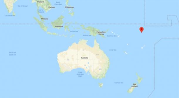
The location of Tuvalu , Pacific Ocean (Google Maps)
The History of Tuvalu
The island was possibly first colonized by members of the Lapita culture from Samoa or Tonga over 2000 years ago. Local foundation myths claim that one island was made by a Tongan deity, and the others by a Samoan supreme being. This may reflect the fact that people from both Tonga and Samoa settled on the island.
It is believed that the atolls and reefs played an important part in the Polynesian colonization of the Pacific. From Tuvalu, Polynesian migrants in canoes travelled to distant islands. Migrants used them as stepping-stones in their journey to Micronesia. Sadly, we know very little about how the societies on the atolls and reefs developed.
Under the leadership of chiefs, known as ‘ Aliki’, traditional Tuvaluan society continued for hundreds of years before it underwent significant changes with the arrival of European traders in the 1820s.
Tuvalu was sighted by the Spanish explorer Álvaro de Mendaña during his first expedition to the Pacific in the late 16 th century. The Spanish, however, did not land. It was only in the 1770s that the island was surveyed by a British explorer. In subsequent years, whalers visited the island and the people of Tuvalu gradually came under western influence. In the 1860s Peruvian mariners visited the islands ostensibly looking for guano. They enslaved many islanders and as a result the population of the island nearly collapsed.
By the 19 th century, the islands were known as the Ellice Islands, named after a British politician and Tuvalu was Christianized by British missionaries from the London Bible Society. Eventually Ellice Islands became a protectorate.
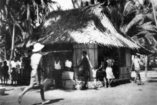
Coast watching headquarters at Nukufetau in 1941, then Ellice Islands ( NZHistory)
During WWI Tuvalu became a colony and was opened up to the world in the following decades. During the Pacific War (1942 to 1945), Tuvalu was very much on the frontline. The atoll was occupied by the US Marine Corps and they used it as a forward base as part of their operations against the Japanese, who occupied the neighboring atoll of Kiribati.
A Naval Construction Battalion (Seabees) built a seaplane port on one of the islands. The islands of Tuvalu were critical to the Allied victories and played a central role in the battles of Tarawa and Makin in November 1943.
After a referendum in 1978, the archipelago gained independence and joined both the Commonwealth and the United Nations. The island became one of the smallest nations in the world and because of its lack of resources and scale, it remained financially impoverished. Many people have emigrated from Tuvalu in recent years.
Landmarks of Tuvalu
There are many beautiful areas in the atolls and reefs, including archaeological sites. One of the most important in this part of the Pacific is the Nanumanga cave, which was discovered in 1986 by scuba divers. The cave is located some 100 feet (31m) below sea level. Evidence was found to indicate that the islands were inhabited before the coming of the Polynesians. Some archaeologists believe that they found proof that Tuvalu was inhabited approximately 8000 years ago.
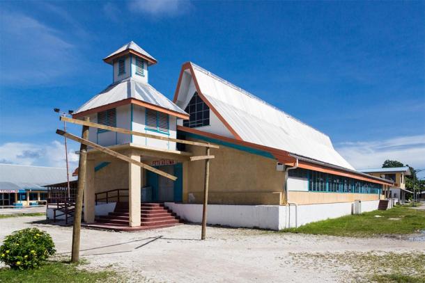
Most prominent building on Funafuti atoll, Fetu Ao Lima or Morning Star Church ( Dmitry/ Adobe Stock)
On the south atoll of Nukulaelae, is the site of an abandoned village that dates to before the coming of the Europeans. A large stone called Te Faleatua , where pre-Christian religious rites were practised can be found here.
Travelling to Tuvalu
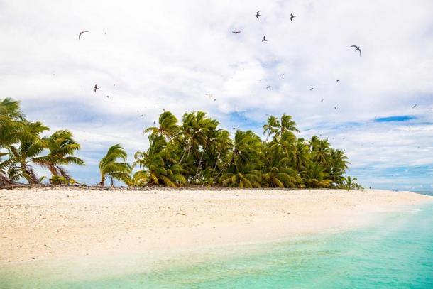
Sandy beach, flock of birds flying. Funafuti atoll, Tuvalu, Polynesia, South Pacific, Oceania. ( Dmitry/ Adobe Stock)
As Tuvalu is remote, it can be difficult and expensive to visit, although there are flights from Fiji and Kiribati. The best way to get around the islands is by hiring a scooter which is a popular mode of transport among Tuvaluans.
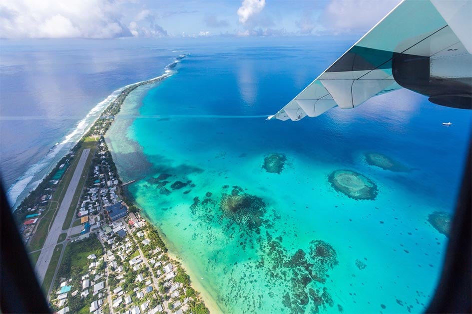
Top image: Aerial view of Funafuti atoll and the airstrip the airport in Vaiaku
Caves of Nanumanga is an underwater cave off the northern shore of Nanumanga, Tuvalu in western Polynesia. It was discovered by two scuba divers in 1986. The caves are located between 37 and 46 m (121 and 151 ft) below sea level, down the wall of a coral cliff. Dark patches on the roof and walls and blackened coral fragments on its floor suggest the use of fire by ancient occupants.
The discovery of the Caves of Nanumanga was made because of interest aroused by a local legend. According to this legend, there existed "a large house under the sea". The existence of this legend led to the scuba diving expedition in 1986, during which the caves were discovered. These are sometimes referred to as the Fire Caves of Nanumanga.
Historical interpretations
The last time that the cave was not underwater appears to have been more than 8,000 years ago, in contrast to the previously accepted view that the Pacific was settled just 6,000 years ago.
Pacificarcheological evidence was questioned after the discovery, in that a vital piece of climatic evidence was missing – an enormous and continuous rise in sea level that began 18,000 years ago and stopped 4,000 years ago and possibly drowned most of the evidence of much earlier human migrations into the Pacific.
In the Journal of Pacific History, Dr. John Gibbons of the University of the South Pacific in Fiji wrote: “…trying to make sense of Pacific prehistory may have been somewhat akin to the efforts of someone who arrives in time for the second act of a play, and then attempts to work out the plot without even realizing that the first act has already taken place."
Dr. Gibbons and his co-author, Dr. Fergus Clunie, believe the Pacific including the Tuvalu islands was colonised by waves of "boat people”, driven from their ancestral coastal homelands in Indonesia and South-East Asia by rising oceans. The known world of Pacific archaeology ends abruptly at a temporal horizon 6,000 years ago, the earliest date of distinctive shards of Lapita Pottery. The pottery is found in coastal regions throughout the south-west Pacific, from the Marquesas in the east, to New Caledonia in the south and the Carolines in the north.
Sea level debates
The caves are currently submerged underneath the ocean, highlighting the profound change in sea level over time. Public controversies regarding sea level changes in contemporary Tuvalu are thus set against this background.
'Every shovel full of dirt provides new data on the ancient people'
Ancient Mexican city unearthed by BYU archaeology team. Director/Editor: Adam Sanders; Filming: Barret Schoenrock & Adam Sanders; Color: Matt Mitchell; Animation: Scott Ure, Matt Mitchell; Producer: Julie Walker.
At an excavation site in northern Mexico, BYU archaeology students and professors recently discovered artifacts that have been buried for 1,000 years, including pottery sherds, hammer stones, maize kernels and — intriguing at a location 250 miles inland — a shell bead from the Pacific Ocean.
The site known as Casas Grandes, also called Paquimé, was a large ancient city that peaked between 1200 and 1400 A.D. The site draws archaeologists worldwide to analyze its unique blend of cultural influences, with evidence (like the seashell) suggesting interactions between the Paquimé and distant peoples. For the past 10 years, a BYU team has studied a lesser-known time, the Viejo period, which predates the main era of Casas Grandes.
“We’re really trying to get at what we call the roots of Casas Grandes,” said BYU archaeology professor Mike Searcy. “There’s a connection between the large city of Paquimé and the site we’re excavating. For some reason the people returned to build yet a bigger city. What brought about this rise of not only a larger population, but the largest city center in the deserts of northwest Mexico?”
In the small farming hamlet just south of Paquimé that the team excavated, a site they named “San Diego,” the group uses pickaxes and shovels to dig long trenches, looking for traces of old structures or trash pits as clues for where to dig wider and deeper. In 2019 they uncovered the floor of the largest known communal structure from the Viejo period, a 9-meter-diameter building big enough to house 30 to 40 people.
“Every shovel full of dirt that we pull out is providing new data on the ancient people who thrived in the desert,” Searcy said. From the site, the group has learned about the resilience and ingenuity of the people living at the San Diego site, including the settlement’s organized building efforts to construct the communal structure.
“The communal structure that we excavated several years ago contained massive posts, two feet in diameter,” said BYU professor Scott Ure. “These were pine tree trunks. We think they probably came from the mountains nearby. Can you imagine cutting one of those down and carrying it all the way here? That required some agreement in the community to work together.”
Such details may hold lessons for those attempting to thrive in difficult climates today. “You see how intelligent and incredible the people were to survive in this environment,” said archaeology student Emily Brown. “The goal of archaeology is to take something mysterious and unknown and make it familiar. You really have a lot of respect for the people when you see very closely what they did.”
The team has employed some advanced technology to document their discoveries, including robotic surveying instruments that map artifacts with millimeter-level precision, survey-grade GPS and unmanned aerial systems that take images of the site from the sky. Managing this technology is an important part of the students’ archaeological training.
Immersion in the culture — from collaborating with fellow archaeology students at the National School of Anthropology and History in northern Mexico on the excavation, to experiencing the food and language of the area — also adds depth to the students’ training that isn’t attainable on campus.
“I can sit in a classroom and talk about what it’s like to move dirt, but there is nothing better for a student than to find their first arrowhead or to pull out a piece of pottery with designs on it we’ve never seen before,” Searcy said. “It’s one of the pinnacles of experiential learning to be in the field with students and watch them make discoveries.”